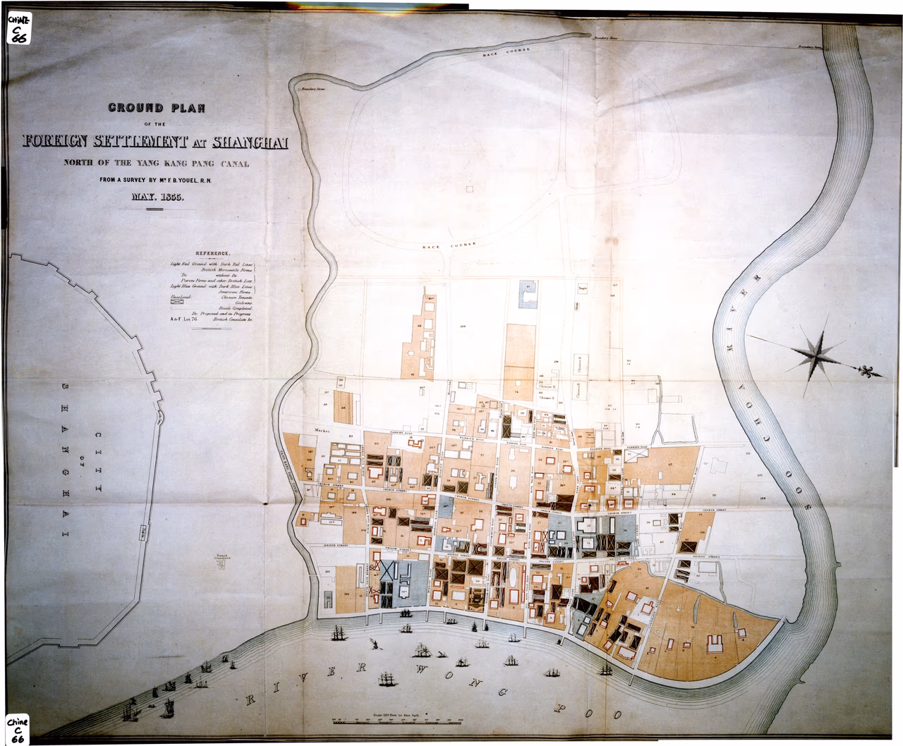
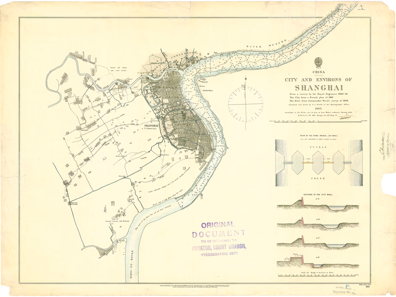
From a survey by the Royal Engineers 1860-61; The City from a French plan of 1861; the River from Commander Ward's survey of 1858
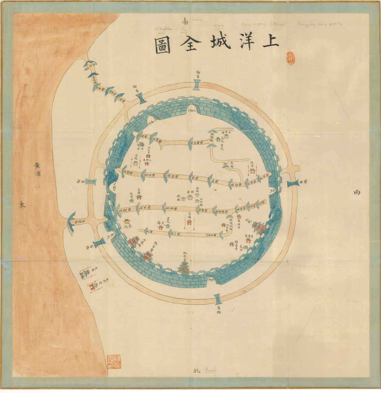
Painted map of the walled city, with the names of bridges, gates, and main buildings in Chinese. The dating by the RGS is open to question. As a document, it may have been produced in 1870, but the map presents a view of Shanghai that predates 1870. In particular, one can see the Temple of Tianhou, that was destroyed in 1860 when the French bombed the insurgents in the neighboring walled city. North China Herald, 25th August 1860, p.134: 'The insurgents had however worked their war round almost to the French quarter, and had planted some flags on the temple of the Queen of Heaven. Our gallant allies set to work, in a manner peculiar to themselves, to drive away the danger, and to prevent its recurrence fired the suburb, which is by far the richest and most important collection of native houses. ... the flames sprang up with fearful grandeur. The name "shangyang" (上洋) is an old designation for Shanghai, one that fell into oblivion after the 19th century (see General description of Shanghae and its environs, extracted from native authorities, 1850, p. 21)
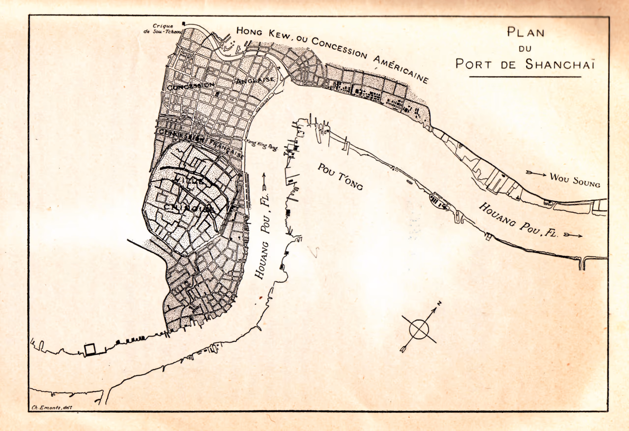
Source: Cordier, Henri, Les origines de deux établissements français dans l'extrême-Orient, Chang-haï--Ning-po (1896)
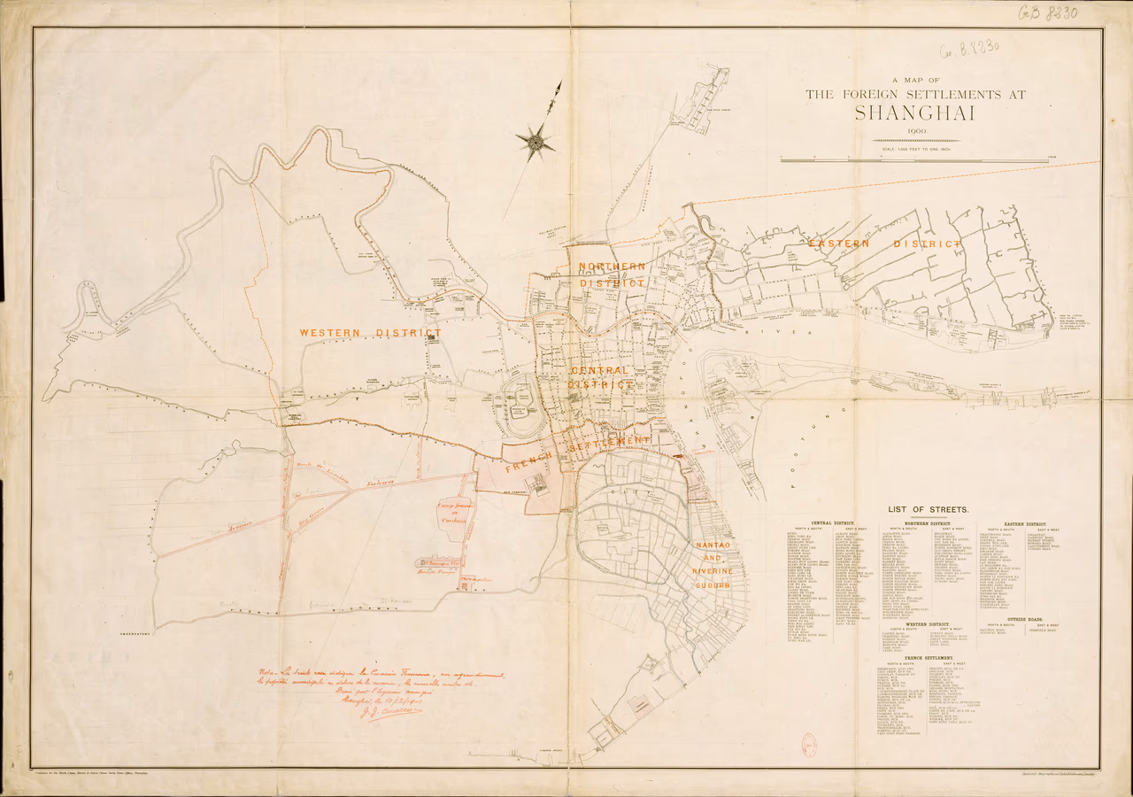
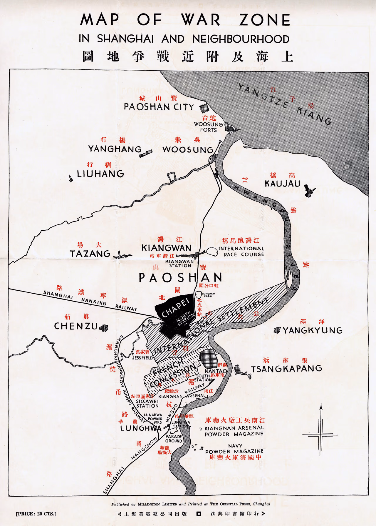
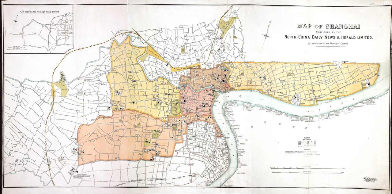
"Published for the North China Herald and North China Daily News Offices, Shanghai"
![Chang-hai et Zi-Ka-Wei [Shanghai et Zicawei]](/_astro/vcMap_ID-335_No-1.BXsymVJy_UMy31.avif)
"Carte dressée par le Capitaine Gadoffre, avec la collaboration des Lieutenants Muselli et Ringue et du Soldat Bouat. 16e régiment d'Infanterie coloniale." "Carte provisoire faite sans instruments de précision - angles déterminés à la boussole Peigné - distances mesurées au pas étalonné." Also available on Earthworks at Stanford University
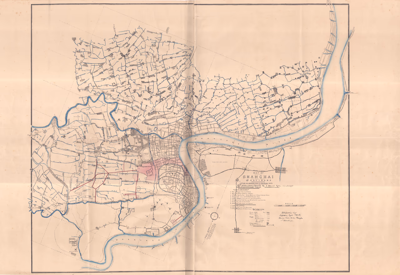
Compiled and arranged from the following maps [see list] for the Intelligence Branch, China Expeditionary Force. 1. Map of Whampoo by A.M. Bisbee 2. Map of the Foreign settlements, Shanghai 3. Shanghai Spoting Mao. Between the Soochow & Sicaway Creeks by C.Cornius 4. Maps of Creeks between the Woodlands & Hongkew Creeks 5. Captain Tweddle's survey of Ditches east of Hongkew Creek 6. Survey between the French Sicaway and the River by S. Bryant Rowe 7. Chinese map of the city and suburbs 8. Sketch map of the camps near Arsenal 9. Sketch map of Pootung 10. Plann shewing houses west of Defense Creek 11. Plan of Shanghai from Intelligence Branch Also available on Earthworks at Stanford University
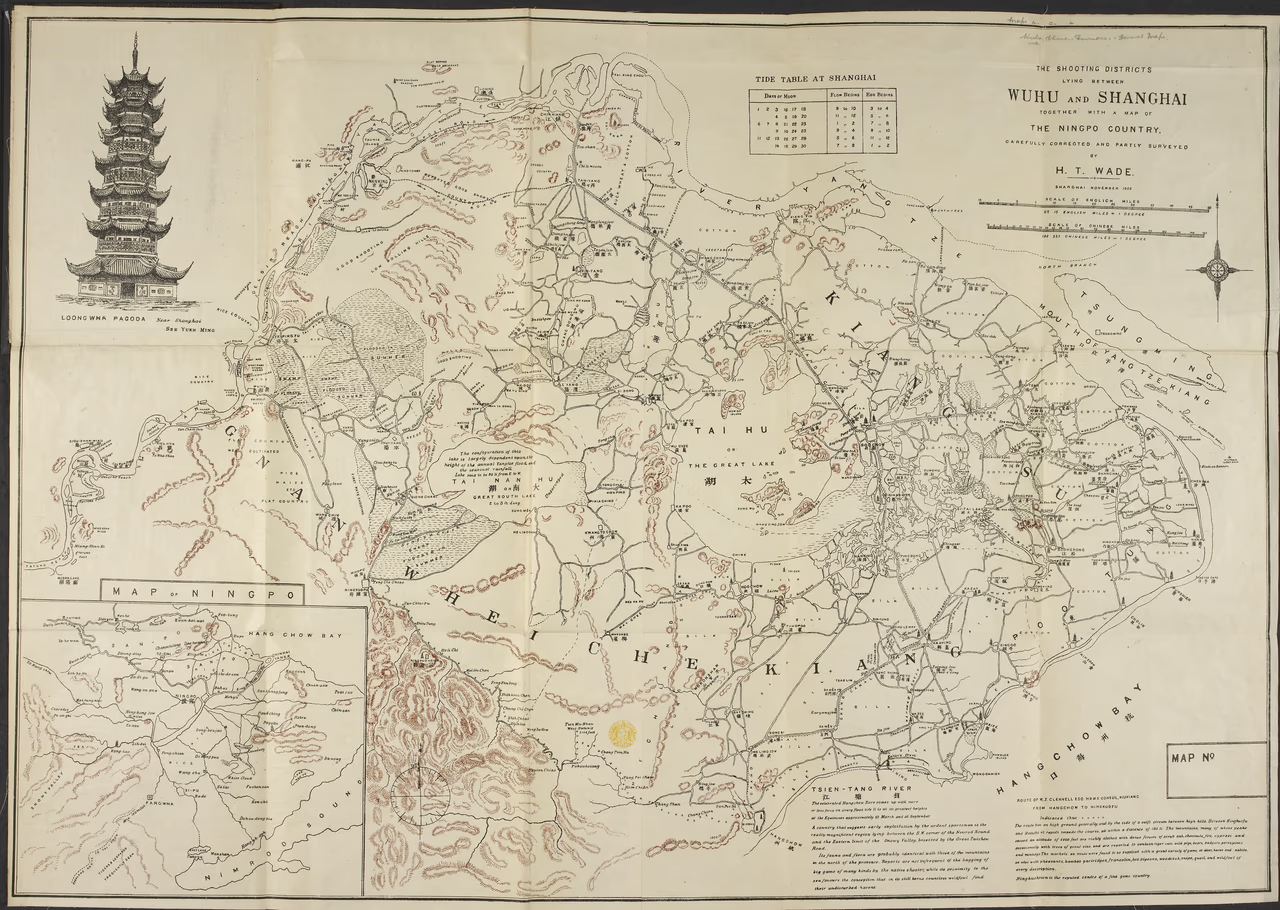
General map of Shanghai region, west to Wuhu. Names in English and Chinese. Indications about shooting (few) - indicates topography (rivers, hills). Included in a hard cover entitled: Wade's sportsman's map Wuhu-Shanghai-Ningpo
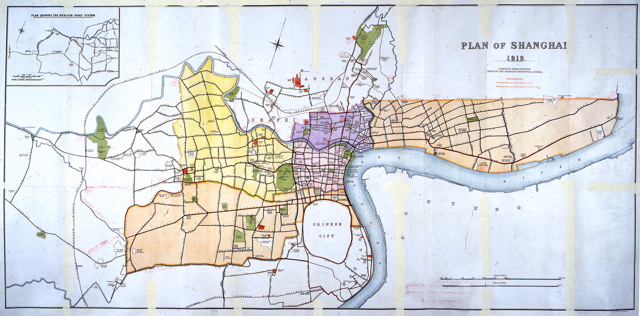
This untitled map accompanied the set of three maps (ID 1873, ID1874, ID1875) showing the land properties owned by foreigners in Zhabei, the northern and western External Roads Areas in 1914. Map prepared for the negotiations held between the British and Chinese government with a view to obtain a further extension of the International Settlement. The Chinese government refused to grant the extension.
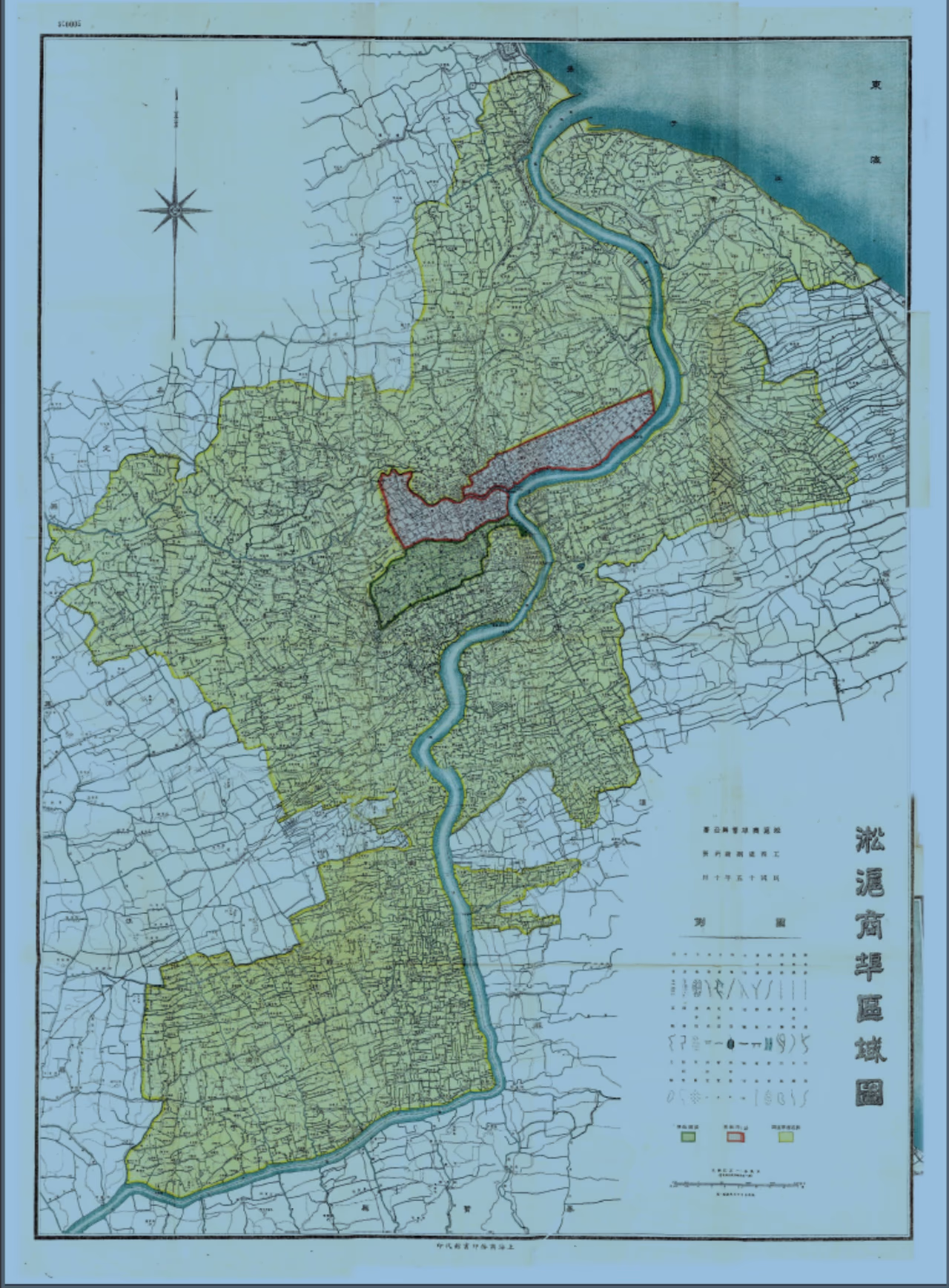
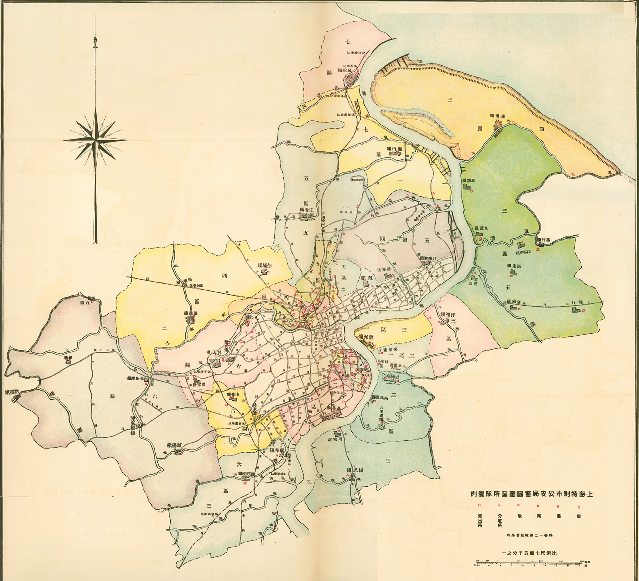
Source: Shanghai tebie shi gong'anju yewu jiyao 上海特別市公安局業務紀要, Shanghai 上海, Shanghai tebie shi gong'anju bian,1928.
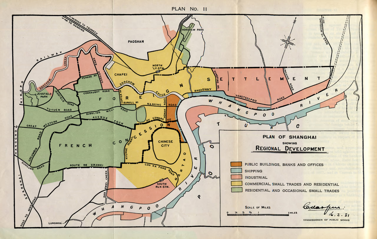
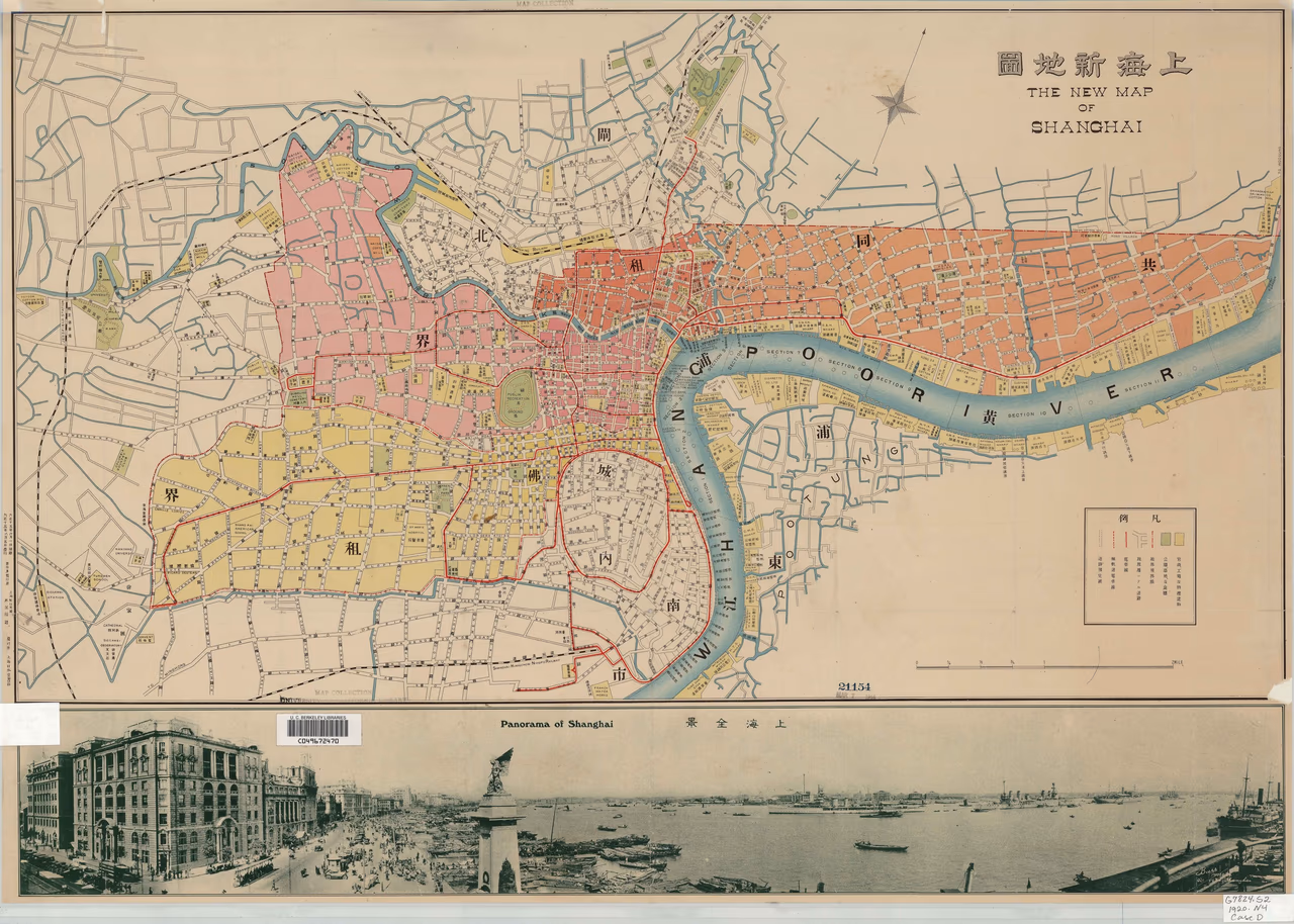
Source:Feetham, Richard, Report of the Hon. Richard Feetham, to the Shanghai Municipal Council (1931)